Oirase stream [奥入瀬渓流]
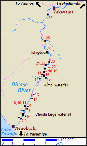
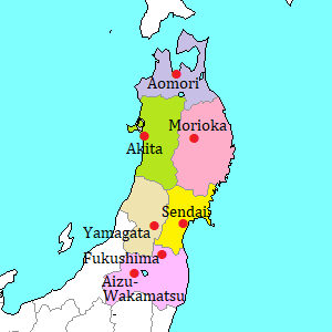
Map of Oirase stream
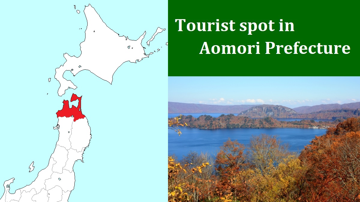
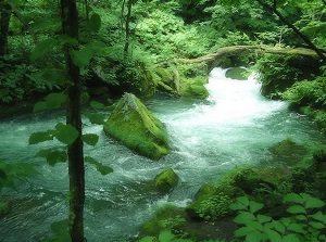
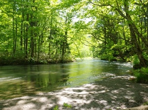
Oirase stream is one of the most popular sightseeing spot in Aomori Prefecture.
Especially, many tourists visit here during the season of new green leaves and autumn leaves.
It is the uppermost stream of Oirase River flowing from Lake Towada and into Pacific Ocean.
Oirase River is the only river flowing out from Lake Towada.
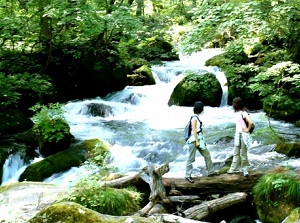
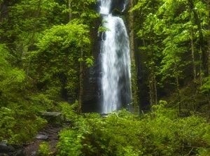
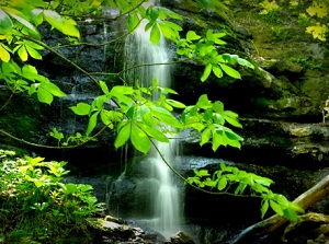
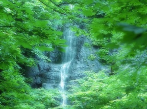
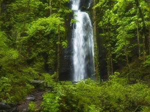
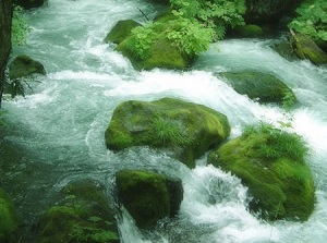
There are many various waterfalls along this stream.
We can enjoy the scenery that clean water flows and the forest bathing.
The area is from Nenokuchi (子ノ口) to Yakeyama (焼山).
The distance is about 14 km.
Nenokuchi is a small town on the east coast of Lake Towada, and here is the starting point of Oirase River.
Yakeyama is a hot spring resort town, which is also called Towadako onsen (十和田湖温泉), additionally there is a ski resort.
A paved road and a walking trail are set up along this stream.
The route buses between Lake Towada and Aomori city or Hachinohe city run on this paved road once or twice every hour.
So if you make good use of them, you may tour here effectively.
When you plan to walk all along this stream, you should allow 5 hours.
Because Yakeyama is about 200 meters lower than Nenokuchi, it is easier to walk from Nenokuchi.
Using a rental bicycle is a good idea.
There are some shops for it at Nenokuchi and Yakeyama.
If you rent a bicycle at Nenokuchi, you can pedal on down slope.
Even in that case, you can return the bicycle at Yakeyama.
There is Ishigedo (石ヶ戸) spot about 8.9 km from Nenokuchi.
There is no house in Oirase, but a small rest facility with shop and parking is put only at Ishigedo.
From Nenokuchi to Ishigedo (8.9 km)
(3) Manryo current
Photo by s-hoshino.com
(4) Choshi-Ootaki
The notation of the distance in the following shows the distance from Nenokuchi.
- (1) Goryo waterfall (五両の滝, 1.0 km)
It is on the left bank.
"Ryo" means an old currency unit in Japan, and is worth current hundreds of thousand yen. "Goryo" is five ryo.
It means that this waterfall has such value. - (2) Senryo rock (千両岩, 1.0 km)
It is a rock in the stream.
In Japan, a box including much money is called "Senryo-bako", and "senryo" is 1,000 ryo.
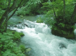
This rock looks like a senryo-bako. - (3) Manryo current (万両の流れ, 1.0 km)
It is the current of stream around Senryo rock.
"Manryo" means 10,000 ryo.
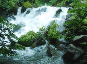
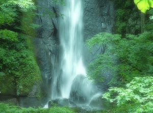
We can see these three spots at one time, so they are called "the view of 11,005 ryo". - (4) Choshi-Ootaki waterfall (銚子大滝, 1.6 km)
This is an only waterfall on Oirase River, and is 20 meters wide and 7 meters high.
Because of this waterfall, fish in Oirase River can't enter into Lake Towada.
Here is a bus stop and a parking.
(5) Samuzawa current
Photo by s-hoshino.com
(6) Kudan waterfall
- (5) Samuzawa current (寒沢の流れ, 1.6 km)
It is the current of a small river flowing into Oirase River at near Choshi waterfall.
As it flows on steep slope, it looks like a waterfall. - (6) Kudan waterfall (九段の滝, 2.0 km)
It is on the left bank.
"Kudan" means "nine steps".
Water has flown on complex stratum, so it has turned stairs.
Water flows gently. - (7) Shimai waterfall (姉妹の滝, 2.6 km)
It is on the right bank.
"Shimai" means "sisters".
A flow of water is divided into two waterfalls by a rock like two sisters. - (8) Furou waterfall (不老の滝, 2.8 km)
It is on the left bank.
"Furou" means "eternal youth".
It was named because the waterfall had never run dry.
It is said that you can live long after drinking this water.
(9) Tomoshiraga waterfall
Photo by s-hoshino.com
(11) Shiraginu waterfall
Photo by s-hoshino.com
- (9) Tomoshiraga waterfall (双白髪の滝, 2.8 km)
It is on the right bank.
"Tomoshiraga" means "long life that the hairs of both husband and wife get gray".
In winter the water is frozen. - (10) Shiraito waterfall (白糸の滝, 2.8 km)
It is on the left bank.
"Shiraito" means "white thread".
Many thin lines of water flow like thread. - (11) Shiraginu waterfall (白絹の滝, 2.8 km)
It is on the left bank.
"Shiragumu" means "white silk".
It is a gently and delicate waterfall, so, it looks like silk literally.
We can see these four waterfalls near Furou waterfall at the same place and time. - (12) Tamadare waterfall (玉簾の滝, 3.9 km)
It is on the right bank.
The water flows all over the rock of horizontal-striped pattern.
(14) Shiranuno waterfall
Photo by photolibrary
(15) Kumoi waterfall
- (13) Iwasuge waterfall (岩菅の滝, 4.2 km)
It is on the right bank.
The Water flows on the surface of rocks. - (14) Shiranuno waterfall (白布の滝, 6.1 km)
It is in the woods on the left bank.
"Shiranuno" means "white cloth".
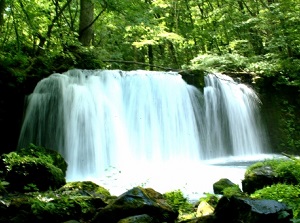
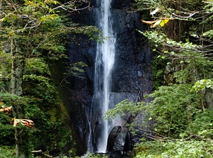
It looks like a cloth which angel wears. - (15) Kumoi waterfall (雲井の滝, 6.3 km)
It is on the right bank.
It is 25 meters high, and the water falls down powerfully through two steps.
Here is a bus stop. - (16) Soryu waterfall (双竜の滝, 6.3 km)
It is about 0.2 km upstream of Kumoi waterfall.
But, when you visit here, you need to climb up a steep path.
"Soryu" means "double-headed dragon", and the water is divided into two flows by a rock.
(17) Shirogane current
Photo by s-hoshino.com
(19) Tobigane current
Photo by s-hoshino.com
- (17) Shirogane current (白銀の流れ, 6.3 km)
"Shirogane" means "silver".
White foams of breaking wave in the Oirase River shine brilliantly with reflected sunlight. - (18) Sensuji waterfall (千筋の滝, 6.5 km)
It is on the right bank.
"Sensuji" means "thousand lines".
Many thin flows fall down.
This is the last waterfall on the river. - (19) Tobigane current (飛金の流れ, 6.5 km)
We can see the sunlit and brilliant rocks in the stream of Oirase River.
- (20) Showa pond (昭和池, 6.7 km)
It is a pond formed by being dammed with fallen rocks by the typhoon in 1958.
The year was the 33th year in Showa era.
(22) Ashura current
Photo by s-hoshino.com
(24) Rock cave of Ishigedo
Photo by photolibrary
- (21) Tsukumo islands (九十九島, 6.9 km)
"Tsukumo" means "99".
Many rocks is dotted like islands in the river.
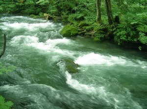
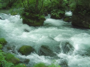
Most rocks are covered with mosses, so the landscape looks like a Japanese garden. - (22) Ashura current (阿修羅の流れ, 6.9 km)
It is a rapid current of Oirase River.
"Ashura" is the fighting god in Buddhism.
This is the most popular spot in Oirase stream and the scenery is used as a typical place. - (23) Makado rock (馬門岩, 7.6 km)
It is a big rock wall.
"Makado" means "gate of horse", then it looks like a gate to Lake Towada.
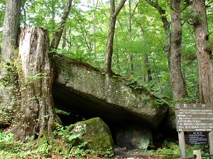
Here is a bus stop. - (24) Ishigedo current (石ヶ戸の瀬, 8.9 km)
This current is relatively gentle in Oirase stream.
On the riverside, there is a rock cave.
It has a legend that a beautiful female robber lived here and she mugged the travelers long ago.When you come from Yakeyama, here is the substantive gate of the scenic area.
Here is a bus stop and a parking.
From Ishigedo to Yakeyama (5.3 km)
(25) Samidare current
Photo by s-hoshino.com
(26) Shimeikei stream
- (25) Samidare current (三乱の流れ, 10.2 km)
It is a junction of Oirase River and the other river.
The rapid and slow currents are mixed. - (26) Shimeikei stream (紫明渓, 13.0 km)
It is a shallow Oirase River, and many round rocks are dotted in the river.
Recently sands are depositing, so the appeal of view is fadind.
But the scenery in the snow is nice.
How to get here
By route bus to Lake Towada,
To Yakeyama, about 2 hours from Aomori, about 1 hours and 25 minutes.
Then from Yakeyama, 9 minutes to Ishigedo, 12 minutes to Makado-iwa, 15 minutes to Kumoi waterfall, 23 minutes to Choshi waterfall and 30 minutes to Nenokuchi.