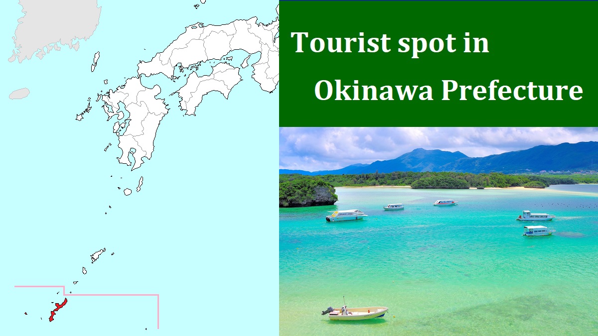
Iriomote Island [西表島]
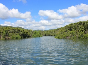
River in Iriomote Island
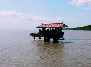
Water buffalo carriage in Yubujima
Iriomote Island ("Iriomotejima" in Japanese) is the second largest island in Okinawa Prefecture after Okinawa Island.
It is located about 25 km west of Ishigaki Island.
The main part of the island is roughly 20 km square, and a peninsula with complex coastline extends at the southwest part of the island.
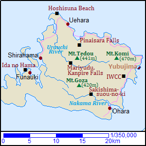
The island is mountainous, and the whole area is covered with natural subtropical forests.
The highest mountain is Mount Komi located in the northeast part of the island and the altitude is about 470 meters.
Mountains in Iriomote Island
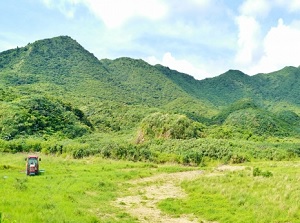
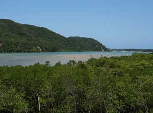
Mangrove forest along Nakama River
Two main rivers (Nakama River, Urauchi River) flow down from the mountains.
The forests have many kinds of endemic species of animals, birds and plants.
Especially, Iriomote wild cat ("Iriomote-yamaneko" in Japanese) discovered in 1965 is well-known.
In this island, malaria had been present since ancient times.
So it had been difficult for people to settle down in this island, and only a few small settlements had been established.
Malaria was eradicated in the 1950s at long last.
As a result, the rich nature has been preserved.
Today, about 2,400 people live in the island.
Some small villages are dotted along the eastern and northern coast.
The ports are in Ôhara village on the southeast coast and in Uehara village on the northwest coast.
Only a road runs along the northwestern, northern and eastern coastlines through the villages.
The inland has only a few walking trails.
A route bus is operated on the main road 4 times a day.
You can use a rental car or a sightseeing taxi, but you have to make a reservation.
We can enjoy the nature in this island.
Basically, to visit the inland, you use the tour boat or rent a canoe in the main rivers.
There are a few hotels and some minshuku in the island.
Eastern part of Iriomote Island
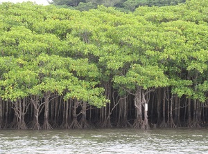
River tour in Nakama River
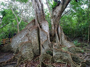
Great Sakishima-suou-no-ki
Ôhara (大原) village is on the southeastern coast of the island and has a port where the ship from Ishigaki Island comes.
It is located at the mouth of Nakama River (仲間川).
Nakama River flows in the south part of the island toward east and the length is about 13 km.
Rich mangrove forests grow along the shore of the downstream site.
The tours by plasure boat are popular.
A big tree "Sakishima-suou-no-ki" is in the forest around 6 km upstream of the river.
The tree is called "looking-glass mangrove" in English and the roots like thin wooden boards are unique.
It is Japan's largest Sakishima-suou-no-ki about 18 meters tall and is about 400 years old.
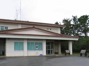
Iriomote Wildlife Conservation Center (IWCC)
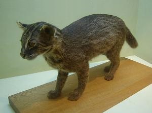
Iriomote wild cat in IWCC
There is Iriomote Wildlife Conservation Center (西表野生生物保護センター, IWCC) near Komi village about 8 km north of Ôhara village.
It is the institute of the Ministry of the Environment.
Some rare creatures including Iriomote wild cat live in Iriomote Island and this facility has protected them.
You can learn the life of the creatures.
And you can see the rehabilitation of damaged Iriomote wild cat on the video monitor.
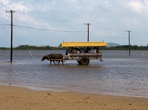
Water buffalo carriage in Yubujima
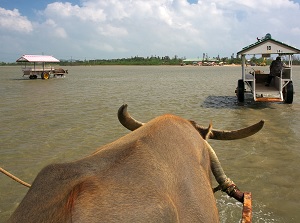
Working water buffalo toward Yubujima
Yubujima (由布島) is small island located about 11 km north-northeast of Ôhara village.
It is a sandy island and about only a dozen people live on the island.
The sea between Yubujima and Iriomote Island is very shallow and the depth is less than 1 meter even at high tide.
Therefore, the water buffalo carriages across the sea are popular.
The distance is about 400 meters.
Originally, the people in Yubujima had done farm work in Iriomote Island.
They had used this carriage as the transportation.
The water buffaloes are very clever and obedient.
The village of Yubujima was destroyed by typhoon in 1969.
After that, a botanical garden of subtropical plants was opened in 1981.
Northwestern part of Iriomote Island
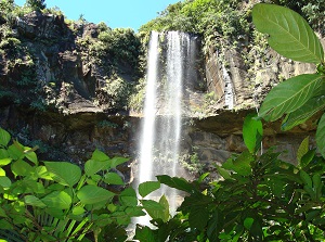
Pinaisara Falls
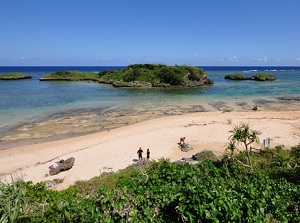
Hoshisuna Beach
Uehara (上原) village is on the northern coast of the island and has a port where the ship from Ishigaki Island comes.
The distance between Uehara and Ôhara on the east coast is about 35 km.
By route bus, it takes about an hour.
Pinaisâra Falls is one of the popular waterfalls in Iriomote Island and is located about 5 km south-southeast of Uehara village.
The waterfall is in Hinai River and the height is about 55 meters.
There is no road to the waterfall.
But we can see it on the bridge crossing Funaura Cove and the distance is 1.5 km.
In addition, canoe tours to visit the river and the waterfall are held.
Hoshisuna Beach (星砂の浜) is located about 3 km northwest of Uehara village.
"Hoshisuna" (or "Hoshizuna") means "star sand".
Star sand is shell of dead "foraminifera" and the size is 1 to 2 millimeters.
Foraminifera is a very small "protist" living in the sea, and the shell is in the form of a star.
It is found in the tropical zone in western Pacific Ocean.
The sands in this beach contain relatively-numerous star sands.
Additionally, "Kaiji-hama" beach in Takatomi Island is also popular for star sand.
Urauchi River
Mariyudu Falls in Urauchi River
Urauchi River (浦内川) is the largest river in Iriomote Island.
It flows from in the center of the island and toward northwest coast.
It is about 19 km long and contains a great volume of water.
The mouth of the river is about 4 km west of Uehara village.
Around the mouth, mudland is formed, so wide mangrove forests spread.
There is Urauchi Bridge about 6 km from Uehara village, and the river tours are held from there.
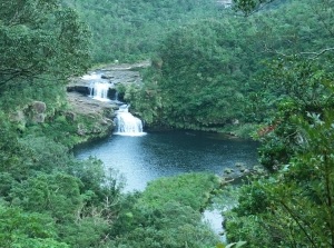
There is Mariyudu Falls about 8 km upstream from Urauchi Bridge.
It is formed in a succession of two small falls, and the waterfall basin is circular in shape.
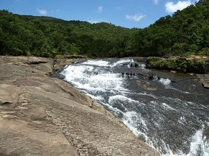
Kanpire Falls is about 250 meters upstream from Mariyudu Falls.
There are a series of some low falls like stairs along the river about 50 meters wide.
Kanpire Falls in Urauchi River
Ida no Hama
There is Shirahama village (白浜) about 13 km from Uehara and is the western end of the road.
From the port, a ship is operated to Funauki village (船浮).
Funauki is the westernmost village in the island and is about 4 km southwest of Shirahama.
The ship is the only method of transportation.
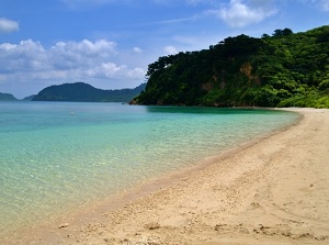
There is Ida no Hama beach (イダの浜) about 1.5 km west of Funauki village.
It has been known as an unexplored beach.
The white sand is beautiful and the water is very clear.
There is no house and shop around the beach.
How to get here
By high-speed ship, from Ishigaki Port, about 35 minutes to Oohara Port, about 40 minutes to Uehara Port.