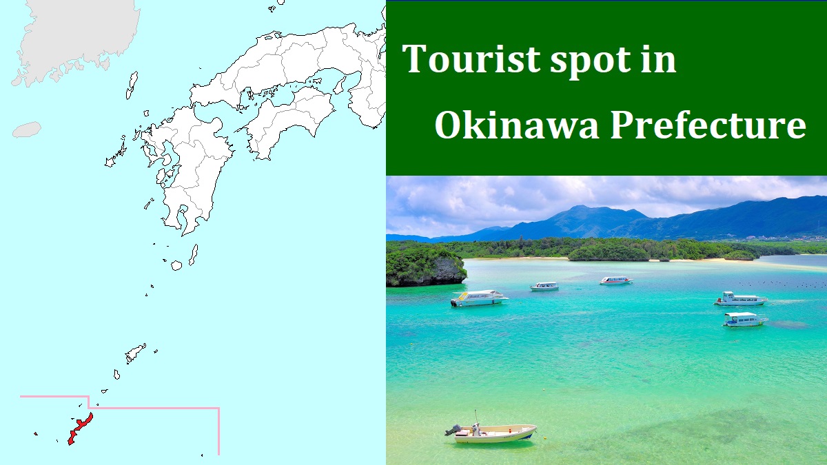
Kume Island [久米島]
Hatenohama near Kume Island
Diving spot around Kerama islands
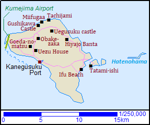
Kume Island ("Kumejima" in Japanese) is located about 100 km west of Naha city on Okinawa Island.
It is about 12 km from east to west and about 11 km from north to south.
The highest mountain is Mount Uegusuku (Uegusuku-dake, 宇江城岳) located in the north part of the island and the altitude is 310 meters.
This island is rich in water, so rice had been cultivated since ancient times.
But the fields were changed to the sugarcane cultivation after the end of World War II.
The sea around the island is very clear.
And there are some popular beautiful beaches in the island.
A coral sand cay extends to the east for about 10 km from the east coast of the island.
There are a few islands and interesting sand banks on it.
Because this island was not attacked during the Battle of Okinawa in 1945, some old spots remain in the island.
So we can enjoy both marine resort and traditional spots in this island.
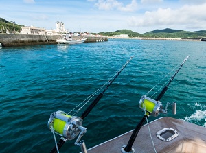
Port of Kume Island
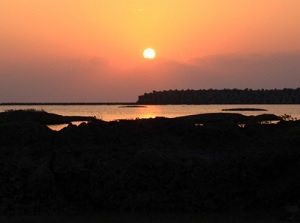
Sunset in Kume Island
There is Kumejima Airport at the west edge of the island.
It has some flights a day from Naha Airport.
Kanegusuku Port is on the southwestern coast and the ferry comes from Naha Tomari Port once or twice a day.
There are some resort hotels, and many small minshuku (Japansese style inn) or resort inns in this island.
Most of them are around Kanegusuku Port and around Ifu Beach on the east coast.
Route bus is operated in the island.
It runs on the roads around the island and to the airport.
But it runs only 5 to 6 times a day.
To tour around Kume Island, you had better rent a car or motorbike, or use a sightseeing taxi.
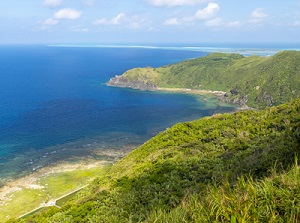
Eastern coast in the island
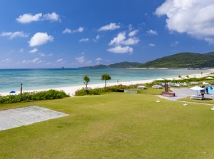
Ifu Beach in Kume Island
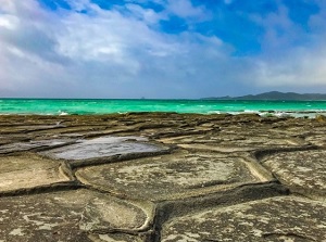
Tatami-ishi in Ojima
Ifu Beach is the main beach on the eastern side of Kume Island.
The first "i" in the word is pronounced long, so it is read as "Îfu Beach".
It is located about 6 km east of Kanegusuku Port.
The beach has white sand and the length is about 2 km.
There are some hotels, minshukus, restautants and shops around the beach.
There is small Ôjima island (奥武島) near Ifu Beach.
Kumejima and Oujima are connected with a bridge.
Tatami-ishi (畳石) spreads on the southwestern coast of Ôjima.
Tatami-ishi is unique flat bedrock like tortoiseshell.
It was formed by columnar joint of andesite about 20 million years ago.
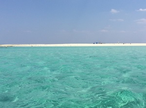
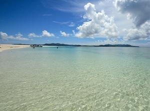
Hatenohama near Kume Island
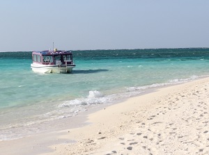
Boat to Hatenohama
There is Ôhajima island just to the east of Ôjima.
There is popular Hatenohama (ハテの浜) to the east of Ôhajima.
Hatenohama is a narrow coral sand cay with three sand banks extending to the east.
The western edge is located about 4 km east of Ifu Beach and the tolal length is about 7 km.
White sand and clear emerald-green waters of the sea are very beautiful.
You can swim or dive around there, but no artificial material in on the banks.
You can go to there by courtesy boat from Ifu Beach.
North part in the island
Hiyajo Banta in Kume Island
Uegusuku castle
Hiyajô Banta (比屋定バンタ) is located about 6 km north of Ifu Beach.
There is a cliff about 200 meters on the northeast side of the island.
There is a popular observatory and we can see the beautiful sea and Hatenohama.
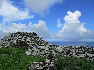
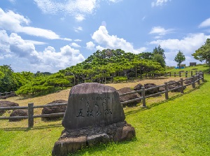
Uegusuku castle (宇江城城) was a castle on the top of Mount Uegusuku.
It was the castle built at the highest place in Okinawa.
It is unknown when this castle was consturucted, but it was destroyed by the troops of Ryukyu Kingdom in 1510.
The steep stone walls surround the castle and the castle was made up of three enclosures.
No route bus visits this ruin.
Tachijami
Miifugaa
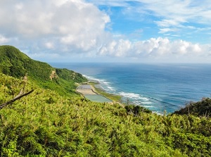
The coast to the north of Mount Uegusuku has steep cliffs and there are a few scenic spots along the coast.
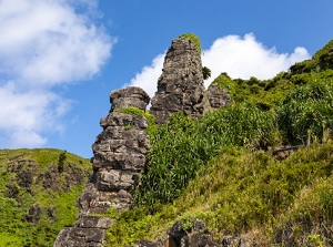
Tachijami is a huge rock stanging on the coast about 1.5 km north of Uegusuku castle.
It is about 40 meters high and 70 meters wide, but it is only 5 meters thick.
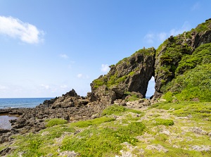
Miifugaa is a large rock with a big hole near the coast and is located about 1 km west of Tachijami.
It is believed that childless woman will be blessed with a newborn by praying the rock.
Gushikawa Castle
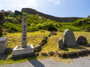
Ruin of Gushikawa Castle
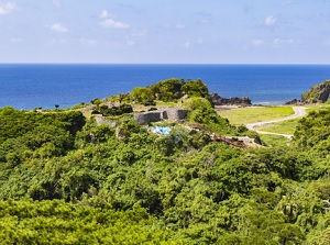
There is Gushikawa Castle (具志川城) on a hill about 0.5 km southwest of Miifugaa.
It was built in the eariy 15th century, but it was destroyed by the troops of Ryukyu Kingdom in the early 16th century.
The steep stone walls surround the castle and the castle was made up of four enclosures.
Many ceramics and coins from Japan and China were excavated from the castle, so it is thought that exchanges were carried out actively by the lord of the castle at that time.
Western side of the island
Obake-zaka (This is a down slope.)
Goeda-no-matsu
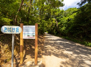
There is a unique spot about 3 km southwest of Gushikawa Castle.
It is a road in the mountain.
It looks like an uphill road, but it is a downhill road in fact.
That is an optical illusion, but the slope is called Obake-zaka meaning specter slope.
Goeda-no-matsu (五枝の松) is a pine tree planted in the 18th century.
It is located about 2.5 km northwest of Kanegusuku Port.
The height is about 6 meters, but the width of the branches is 28 meters.
It is designated as a national nature treasure.
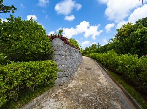
Road to Uezu House
Storehouse in Uezu House
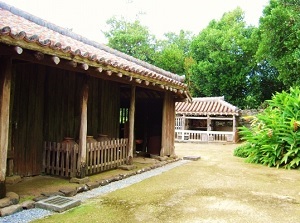
Uezu House (上江洲家) is the old house of a warrior class built in 1754.
It is the oldest house in Okinawa, and is designated as a nationally important cultural property.
Uezu family had culitivated cotton and tea, and promoted the weaving industry in the island.
How to get here
By airplane, about 35 minutes from Naha Airport.
By ship, about 3 hours and 15 minutes to 4 hours from Naha Tomari Port.