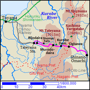
Tateyama Kurobe Alpine Route [立山黒部アルペンルート]
About Mount Tateyama
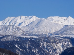
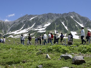
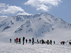
Mount Tateyama
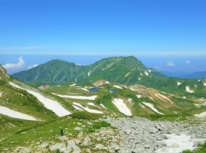
Murodo-daira of Mount Tateyama
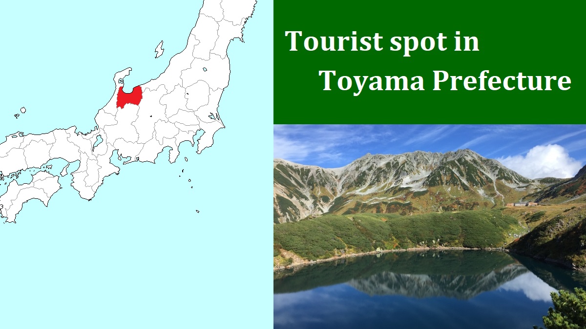
Mount Tateyama (立山) is the name of a mountain range running from north to south at the east part of Toyama Prefecture.
The length is over 30 km, and it has been said that the mountain range has 72 peaks.
It is a part of Northern Alps, and another mountain range with Mount Shirouma runs to the east of it.
It is on the border between Toyama and Nagano Prefectures.
Kurobe River forms a very deep and steep valley between both mountain ranges.
Generally, three peaks located at the center of the mountain range are called Tateyama and the altitude of the highest peak is 3,015 meters.
Tateyama has been an object of ancient mountain worship.
It has a legend.
In the late 7th century, a boy of samurai family hunted with a white hawk.
But the hawk had flown away toward Mount Tateyama, then he chased.
When he was chasing, a bear appeared.
So he shot it with his arrow.
The bear ran away with dropping its blood.
So, he traced the dropped blood.
The blood marks led to a cave in current Murodo-daira.
He entered the cave.
He saw Amida Buddha embedded his arrow there.
Buddha said to him.
"I led you here. Be a priest, and found a sacred mountain."
He reformed himself.
He built a shrine at the foot of Mount Tateyama.
Since that, the shrine became Oyama Shrine, and later the branch shrine was built on the top of Oyama peak of Mount Tateyama.
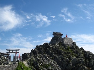
Oyama shrine on Mount Tateyama
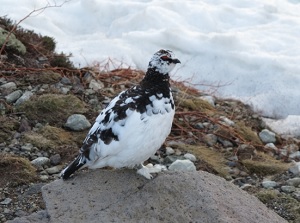
Ptarmigan in Mount Tateyama
Tateyama is seen at almost every part of Toyama Prefecture, and the scenery is beautiful.
And it has rich natural, and there are many birds, animals and alpine plants.
Especially, "rock ptarmigan" ("raichô" in Japanese) living in highland is a well-known bird.
It is in danger of extinction and is designated as the special national treasure.
Tateyama is the main habitat in Japan, but only about 200 ptarmigans are confirmed now.
So, you are happy when you visit Mount Tateyama and find them.
Tateyama Kurobe Alpine Route
Tateyama Kurobe Alpine Route is a popular scenic route crossing Mount Tateyama and Northern Alps.
We can enjoy the noble and beautiful scenery of Tateyama at a short distance.
The western entrance is Tateyama station of Toyama Chihou Railway, and the eastern entrance is Ogisawa bus terminal in Omachi city in Nagano Prefecture.
(Both "o"s in "Ogisawa" and "Omachi" are pronounced long.)
The distance between both entrances is about 25 km.
Tateyama station is at the western foot of Mount Tateyama, and Ogisawa terminal is on the eastern mountainside of Northern Alps.
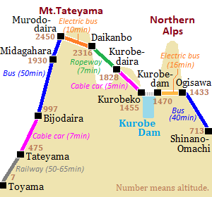
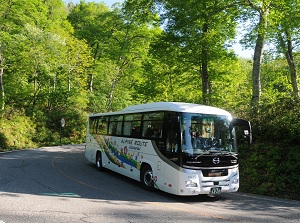
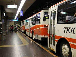
This route runs through high mountains and deep valley, but even ordinary tourists can visit easily by route bus, special trolleybus, cable car and ropeway.
Basically, tourists can't travel this route by private car.
Tateyama terminal station is at the level of 475 meters, and Ogisawa bus station is at the level of 1,433 meters.
And the highest spot on this route is Murodo plateau at the level of 2,450 meters.
So you need the warm clothes even in summer.
In addition, this route is closed from December to the middle of April.
The tourist must use various transportation and needs the ticket when you get on a transportation.
Basically, there is no pass that you can use all transportation many times.
There are the one-way tickets between Tatetama station and Ogisawa and the tickets that turn back half way on the route.
Commonly, it takes about 6 to 7 hours to pass through the route between Tateyama station and Ogisawa terminal.
In the season from late April to early May and around October, many tourists visit here.
Because each terminal is crowded, it takes a few extra hours.
In addition, general tourists can't go to Kurobe Gorge from Tateyama Kurobe Alpine Route because there is only a steep, hard and dangerous rocky path.
Bijodaira (美女平)
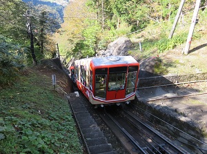
Tateyama Cable car to Bijodaira
Photo by Tateyama Kurobe Alpine Route
Bijodaira
Photo by Tateyama Kurobe Alpine Route
Bijodaira is a highland on a western end of a ridge of Mount Tatetyama.
It is located only 1 to 2 km east of Tateyama station.
But the difference of elevation is about 500 meters, and the highland is located at the level of about 1,000 meters.
Rich and calm forests spread and many birds make their habitat there.
There are some walking trails in the forests.
Bus to Murodo-daira
Photo by Tateyama Kurobe Alpine Route
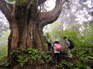
Bijo-sugi in front of Bijodaira station
Photo by Tateyama Kurobe Alpine Route
By the way, "bijo" means "beautiful woman" and "daira" means "highland".
There is another legend about the above-mentioned boy in Bijodaira.
He had been working to found a sacred mountain in Mount Tateyama.
And he had a beautiful bride.
She wanted to meet him by any means, so she climbed Mount Tateyama.
She could meet him, but he sent her back because he didn't finish the work.
She went down the mountain reluctantly.
On the way, she commited her love for him to a cedar tree.
After his foundation of the work, she succeeded in love at last.
There is a huge cedar tree "Bijo-sugi" in front of the station, and it is said that she wished to the tree.
Of course, it is one of spots for lovers.
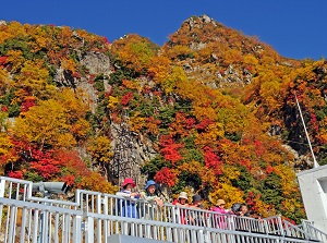
Shomyo Falls (称名滝)
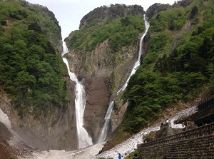
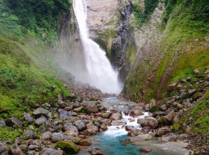
Shomyo Falls is a waterfall located about 8 km east of Tateyama station.
Both "o"s in the word is pronounced long, so it is read as "Shômyô-daki" in Japanese.
It is the highest falls in Japan, and the height is about 350 meters.
The water from Midagahara plateau falls down, and it flows into Shomyo River.
The river forms the valley of norhtern side of Bijodaira ridge.
It is out of the main route of Tateyama Kurobe Alpine Route.
So a route bus is operated from Tateyama station.
It takes about 20 minutes.
But, we can also see the falls from the route bus between Bijodaira and Midagahara.
Midagahara Plateau (弥陀ヶ原)
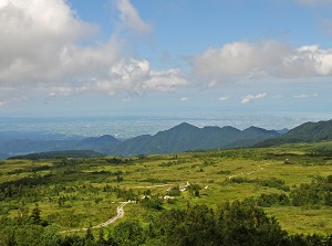
Midagahara
Photo by Tateyama Kurobe Alpine Route
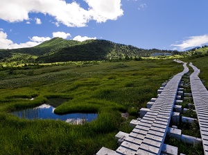
Marsh in Midagahara
Photo by Tateyama Kurobe Alpine Route
Midagahara is a gentle plateau on the west side of Mount Tateyama.
It spreads at the level of about 2,000 meters.
The bus stop is located about 9 km east of Bijodaira.
This plateau had been formed by erupted lava from Mount Tateyama volcano more than 100 thousand years ago.
Marshes spread around the plateau, then they are filled with many alpine plants such as daylilies, cottongrasses, etc. in summer.
There are some walking trails in this area, and a few hotels are around the bus stop.
Murodo-daira (室堂平)
Murodo-daira
Photo by Tateyama Kurobe Alpine Route
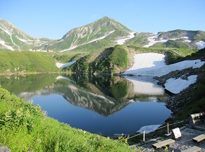
Mikuriga-ike in Murodo-daira
Photo by Tateyama Kurobe Alpine Route
Murodo-daira is the lava plateau just west of the main peaks of Mount Tateyama.
The alititude is about 2,450 meters.
The second "o" in the word is pronounced long, so it is read as "Murodô-daira" in Japanese.
This lava plateau had been formed about 50 thousand years ago.
So there are some crater lakes such as Mikuriga-ike lake (ミクリガ池) and Midoroga-ike lake (ミドリガ池).
And, we can see the emissions of volcanic gas in Jigokudani valley (地獄谷).
These spots are dotted to the north of Murodo-daira station.
Creeping pines grow around Murodo-daira, so ptarmigans live in the forest.
Midoroga-ike in Murodo-daira
Photo by Tateyama Kurobe Alpine Route
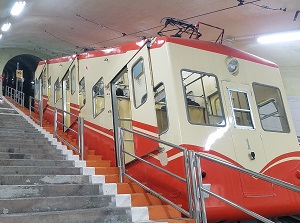
Trolleybus to Daikanbo
Photo by Tateyama Kurobe Alpine Route
There are a few hotels and Tateyama Nature Conservation Center with museum around Murodo-daira station.
Murodo-daira station is the terminal of the bus from Tateyama station.
And Tateyama Tunnel Trolleybus is operated to Daikanbo.
"Murodo" means "mountain lodge for Japan's ancient mountain worship".
There is the mountain lodge built in the 16th century about 1 km east of Murodo-daira station.
It is designated as a nationally important cultural property.
Murodo-daira in April
Photo by Tateyama Kurobe Alpine Route
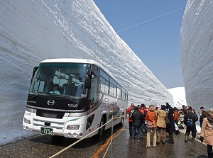
Yuki no Ootani in Murodo-daira
Photo by Tateyama Kurobe Alpine Route
In addition, Murodo-daira area has very much snow in winter.
From open of the route in the middle of April to the middle of June, the bus runs along the huge snow walls around Murodo-daira terminal.
It is called "Yuki no Ootani" in Japanese. (雪の大谷, Great valley of snow)
The height of the snow wall is 10 to 20 meters.
In the period, the event walking along the snow wall is held.
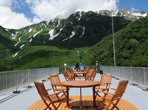
Daikanbô (大観峰)
Observatory of Daikanbo
Photo by Tateyama Kurobe Alpine Route
Ropeway between Daikanbo and Kurobe-daira
Photo by Tateyama Kurobe Alpine Route
Daikanbô is a transfer station between trolleybus from Murodo-daira and ropeway from Kurobe-daira.
It is located on the cliff wall on the eastern side of Mount Tateyama.
The view from the observatory is good.
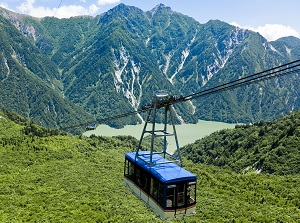
Kurobe-daira (黒部平)
Observatory of Kurobe-daira
Photo by Tateyama Kurobe Alpine Route
Cable car between Kurobe-daira and Kurobe Dam
Photo by Tateyama Kurobe Alpine Route
Kurobe-daira is a transfer station between ropeway from Daikanbo and cable car from Kurobe Dam.
In the station, there are an observatory room and a restaurant.
And there is a garden around the station.
Kurobe Dam (黒部ダム)
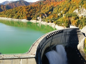
Kurobe Dam
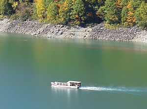
Garve on Kurobe Lake
Kurobe Dam is the largest dam in Japan.
It is constructed upstream of Kurobe River, and is located between the main peaks of Mount Tateyama and Northern Alps.
The construction of the dam started in 1956, and it was completed in 1963.
This location is too interior and steep.
Therefore, the constuction was very difficult.
That has been sometimes introduced on a movie or TV documentaries.
Now this is one of the popular spots on Tateyama Kurobe Alpine Route.
There is Kurobeko station of cable car from Kurobe-daira on the west side, and there is Kurobe Dam station of electric bus from Ogisawa on the east side.
As Tateyama Kurobe Alpine Route, toutists cross this dam on foot.
The pleasure boat "Garve" is operated on the dammed lake.
It takes about 30 minutes for the cruising.
(The operation ends in November 2024 because of aging of the ship.)
How to get here
To Tateyama station
By Toyama Chihou Railway, about 50 to 65 minutes from Toyama station.
To Ogisawa
From JR Matsumoto station to Shinano-Omachi, about 1 hour and 10 minutes by local train of JR Oito Line.
Then, about 40 minutes by route bus from Shinano-Omachi station.