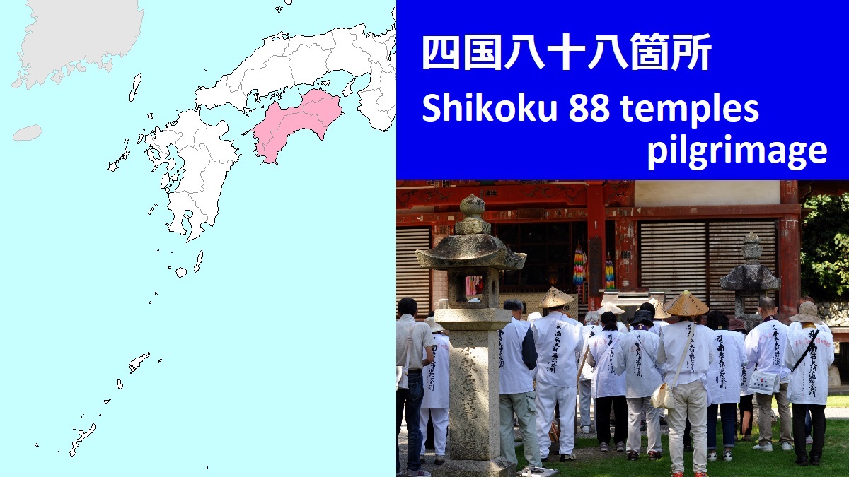
Temples in Tokushima Prefecture (No.1 - 23)
 Temples for the pilgrimage in Tokushima Pref.
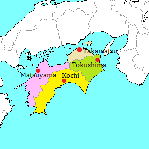
Tokushima Prefecture is located in the east part of Shikoku island.
It is the first prefecture of the pilgrimage.
For the pilgrim, Tokushima Prefecture is called as Hosshin no Dôjô (発心の道場).
It means "Training school of awakening".
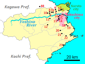
The starting point is Ryôzenji temple (霊山寺)
It is located about 10 km west of Naruto city at the northeast edge of Tokushima Prefecture.
And it is about 18 km northwest of Tokushima city which is the capital of the prefecture.
Because of the first temple, you can buy the clothes and some goods for pilgrimage in this temple.
Of course, you must worship the temple.
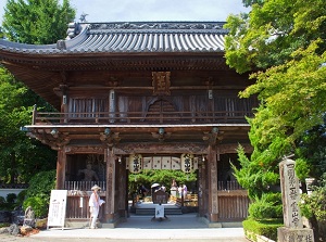
No.1 Ryozenji
Photo by Tokushima Prefecture
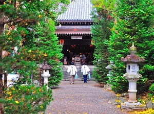
Main temple of Ryozenji
Photo by Tokushima Prefecture
Yoshino River flows through Tokushima Prefecure from west to east.
The temples from No.1 to 10 are on the north side of Yoshino River.
The area is a rural area.
The pilgrim walks toward west.
| No. | Temple name | Kanji Char. | Distance (km) to next temple |
|---|---|---|---|
| 1 | Ryôzenji | 霊山寺 | 1.2 |
| 2 | Gokurakuji | 極楽寺 | 2.6 |
| 3 | Konsenji | 金泉寺 | 5.4 |
| 4 | Dainichiji | 大日寺 | 2.0 |
| 5 | Jizôji | 地蔵寺 | 5.1 |
| 6 | Anrakuji | 安楽寺 | 1.2 |
| 7 | Jûrakuji | 十楽寺 | 4.0 |
| 8 | Kumadaniji | 熊谷寺 | 2.5 |
| 9 | Hôrinji | 法輪寺 | 3.8 |
| 10 | Kirihataji | 切幡寺 | 10.2 |
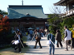
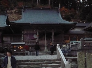
No.6 Anrakuji
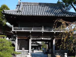
No.10 Kirihataji
No.11 Fujiidera is on the south side of Yoshino River.
After that, the pilgrim must walk on a steep and long mountain road.
No.12 Shôsanji is located in a deep mountain at about 800 meters above sea level, and no one lives around it.
| No. | Temple name | Kanji Char. | Distance (km) to next temple |
|---|---|---|---|
| 11 | Fujiidera | 藤井寺 | 28.2 |
| 12 | Shôsanji | 焼山寺 | 25.7 |
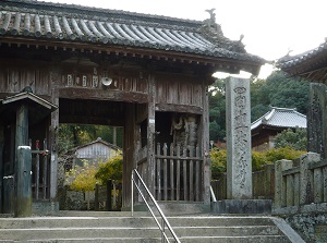
No.11 Fujiidera
No.12 Shosanji
From Shôsanji, the pilgrim must walk down a mountain road.
It is about 7 km long, and the pilgrim reaches a small village, at last.
No.13 Dainichiji is located about 18 km east-northeast of the village, and is in the west part of Tokushima city.
The temples from No.13 to 17 are in the same area.
| No. | Temple name | Kanji Char. | Distance (km) to next temple |
|---|---|---|---|
| 13 | Dainichiji | 大日寺 | 2.4 |
| 14 | Jôrakuji | 常楽寺 | 0.8 |
| 15 | Kokubunji | 国分寺 | 1.7 |
| 16 | Kannonji | 観音寺 | 2.8 |
| 17 | Idoji | 井戸寺 | 17.6 |
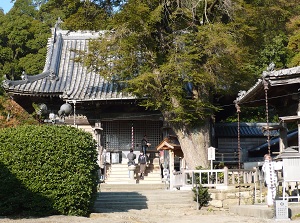
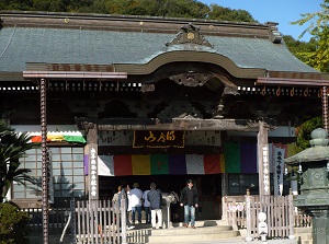
No.14 Jorakuji
No.17 Idoji
The temples from No.18 to 23 are around the east coast of Tokushima Prefecture.
But they are relatively inland, and each other's distance is about 10 to 20 km.
Especially, No.20 Kakurinji and No.21 Tairyûji are in the steep mountain.
But, to No.21 Tairyûji, a ropeway is set up from the foot, so it is relatively easy to visit.
| No. | Temple name | Kanji Char. | Distance (km) to next temple |
|---|---|---|---|
| 18 | Onzanji | 恩山寺 | 4.4 |
| 19 | Tatsueji | 立江寺 | 15.1 |
| 20 | Kakurinji | 鶴林寺 | 11.2 |
| 21 | Tairyûji | 太龍寺 | 13.5 |
| 22 | Byôdôji | 平等寺 | 21.4 |
| 23 | Yakuouji | 薬王寺 | 77.2 |
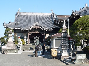
No.19 Tatsueji
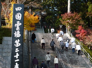
No.21 Tairyuji
The last No.23 Yakuouji is near a fishing port town on the east coast of Tokushima Prefecture.
After the worship, the pilgrim walks toward Kochi Prefecture.
But, to reach the first temple in Kochi Prefecture, the pilgrim must walk about 77 km along the coast.
To go to there, the pilgrim can use railway and route bus.
No.23 Yakuouji is near JR Hiwasa station.
Get on the train for Kaifu. (It is JR Mugi Line and is operated every about 2 hours.)
It takes about 40 minutes, and change to the train of Asa Seaside Railway at Kaifu.
The train goes to Kannoura. It takes 11 minutes.
From Kannoura, the route bus for Muroto-Eigyosho departs soon.
It takes about 45 minutes to Geopark-center stop.
Change to the bus for Aki-Eigyosho, and it also departs soon.
It takes about 9 minutes to Muroto-Misaki stop.
The place is near Cape Muroto (Muroto-Misaki).
No.24 Hotsumisakiji is on a hill near the cape.