Shichiri-mihama coast [七里御浜]
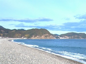
Shichiri-mihama
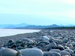
Beach of Shichiri-mihama
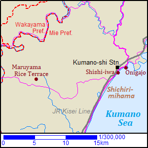
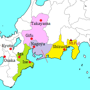
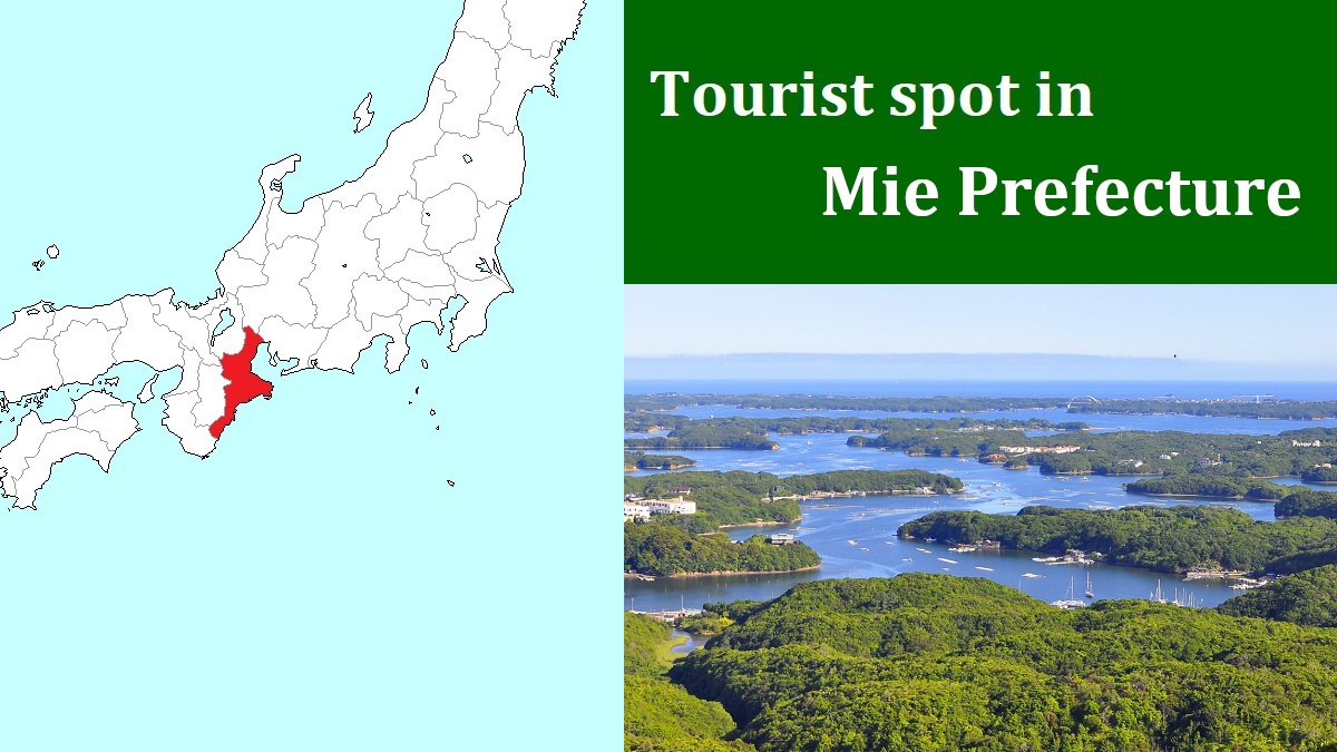
Map around Kumano city
Shichiri-mihama is a straight coast from the center of Kumano city to the south.
Kumano is the southernmost city in Mie Prefecture and is located about 90 km southwest of Ise city.
The southeastern coast in Mie Prefecture faces Kumano Sea belonging to the Pacific Ocean and has a indented coastline.
Shichiri-mihama coast is connected the southern end of the indented coast, and the straight coastline extends.
"Shichiri" means "seven-ri".
"Ri" is a unit of length in old Japanese measure system, One-ri is about 3.9 km.
So seven-ri is about 27 km, but the length of the coast is actually about 20 km.
Probably, seven has been a lucky number in Japan, so they may have named the number as the long coast for traveler.
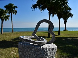
A monument by Shichiri-mihama
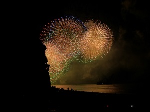
Kumano Fireworks Festival at Shichiri-mihama
In fact, the way along Shichiri-mihama is a part of Kumano-Kodo (熊野古道) which are the ancient pilgrimage routes designated a UNESCO World Heritage site.
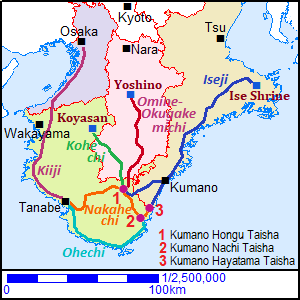
All routes of Kumano-Kodo
It is on Iseji Route from Ise Shrine to Kumano three shrines.
Along the long coast, a national road and JR Kisei Line run.
Most parts of the coast are not sandy but the beach of gravel.
But loggerhead turtles come on this beach to spawn.
And, Kumano Fireworks Festival is held around Shichiri-mihama on August 17 every year.
About 10,000 fireworks were launched around the beach from 19:00 to 21:00.
Over 150 thousand people visit for the festival.
There are a few sightseeing spots of unique rocks around the center of Kumano city at the northern end of Shichiri-mihama.
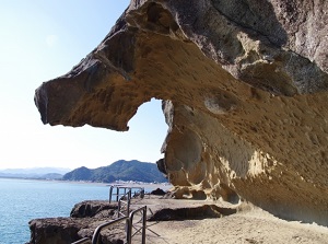
Shishi-iwa rock (獅子岩)
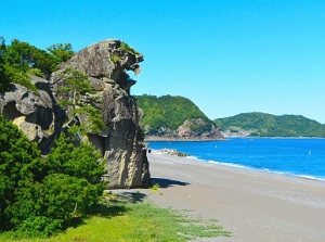
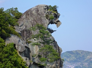
Shishi-iwa is a rocky cliff by Shichiri-mihama and is located about 0.7 km south of JR Kumano-shi station.
The top of the cliff about 25 meters high is similar to a head of roaring lion.
"Shishi" means "lion".
Of course, it has formed by the action of sea waves.
It is designated as a nation's special place of scenic beauty and natural monument and is also designated as a part of World Heritage site.
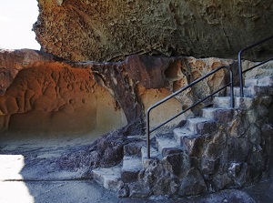
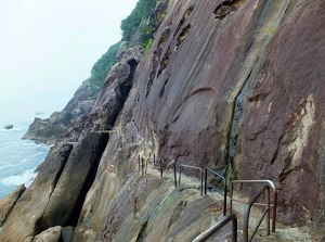
Onigajo (鬼ヶ城)
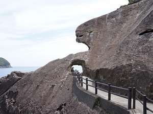
Onigajo is a rocky coast located about 1.8 km east of JR Kumano-shi station.
The last "o" is pronounced long, so it is read as "Onigajô".
This is the the southern edge of the indented coast from Shima Peninsula.
There are strangely shaped rocks along the coast for about 1 km.
"Onigajo" means "Castle of Demon".
The coast is at the foot of a small mountain 153 meters high above sea level.
Around 1523, the samurai lord in this area built a castle on this mountain.
He called it "Castle of Demon".
But the various unique rocks are exactly "Castle of Demon".
A walking trail is set along the coast.
The main entrance to Onigajo is on the east side, and there is Onigajo Center for tourist.
In addition, you can climb the mountain from Onigajo Center and visit the ruin of the castle.
There are about 2,000 cherry trees around the mounatin, and cherry blossoms in Onigajo are very good from March to early April.
How to get here
By JR limited express, about 3 hours and 10 minutes from Nagoya to Kumano-shi.
Or, by JR limited express, about 4 hours and 40 minutes from Shin-Osaka to Shingu.
From Shingu to Kumano-shi, about 20 minutes by limiued express, about 40 minutes by local train.
By express bus, from Nagoya to Onigajo, Kumano-shi, about 3 hours and 40 minutes.
From Tokyo, about 9 hours (night bus).