South Bôsô area (南房総)
Cape Nojimazaki
Flowers in Shiramazu
Photo by Minamiboso City
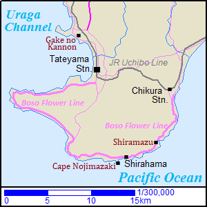
South Bôsô is generally the area of the southernmost part in Bôsô Peninsula.
The east and south sides face the Pacific Ocean and the west side faces Sagami Bay.
This area has a temperate climate, so it is richly cultivated with flowers.
In winter, we can see the beautiful flowers in this area.
The central city is Tateyama (館山) located on the west side of the peninsula, and there is Chikura town (千倉) on the east side of the peninsula.
Because Bôsô Peninsula has low hills, the coastline in South Bôsô is not so steep.
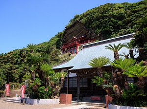
Kan-non temple on a cliffside (崖の観音)
Gake Kan-non
Photo by Tateyama City
Kannon-do of Daifukuji
It is a unique temple on a cliffside, and is located about 5 km northwest of JR Tateyama station.
The formal name of the temple is Daifukuji (大福寺).
It is said that a high priest Gyoki founded this temple in 717 for luck to fishing people.
In Japanese, it is called "Gake no Kan-non" or "Gake Kan-non".
"Gake" means "cliff" and "Kan-non" is one of Buddhist gods.
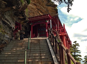
Entrance to Kannon-do
Terrace of Kannon-do
Photo by Tateyama City
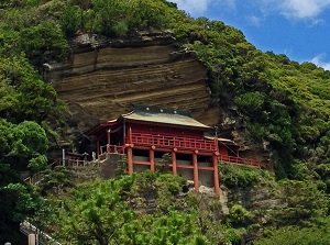
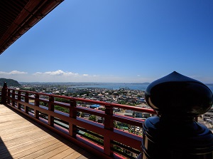
There are some buildings in this site, but the main "Kannon-do" is on the steep cliffside.
An image of the Goddess of Kan-non with 11 faces is carved on the surface of the cliff, and the temple of Kan-non-do covers the image.
We can see the view of Tokyo Bay and Tateyama city from its terrace.
It takes about 20 minutes by route bus to Namuya from JR Tateyama station.
Boso Flower Line (房総フラワーライン)
Boso Flower Line
Photo by Tateyama City
Boso Flower Line
Photo by Minamiboso City
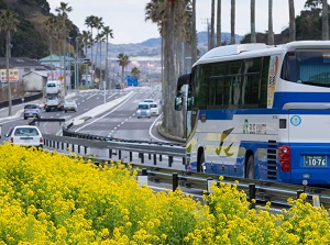
Boso Flower Line is the road along the coastline from Tateyama city to Chikura town, and the length is about 40 km.
This is the main route touring South Boso area.
There are some sightseeing spots along this route, and we can see the scenery of the sea and the fields of flowers.
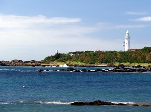
Cape Nojimazaki (野島崎)
Cape Nojimazaki
Photo by Minamiboso City
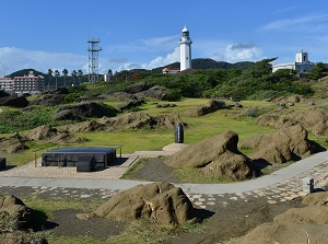
Park around Nojimazaki lighthouse
Photo by Minamiboso City
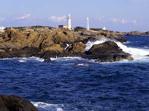
Nojimazaki is the southernmost cape in Boso peninsula, and is located about 11 km south of Tateyama city.
There is a white lighthouse on the cape.
It was built in 1870 and was rebuilt in 1946.
The height is 29 meters.
It is one of the popular spots in South Boso area.
We can climb to the top.
And there is a museum about this lighthouse near it.
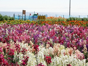
Shiramazu (白間津)
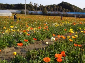
Poppies in Shiramazu
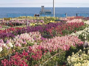
Flowers in Shiramazu
Photo by Minamiboso City
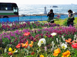
Shiramazu is a district located about 7 km south of JR Chikura station.
There are many fields of flower cultivating for markets and visitors around this district, and the scenery is a symbol of South Boso area in winter.
The main season is from January to March, and we can see the colorful flowers such as poppy, stock, pot marigold and other some kinds.
How to get here
From Tokyo to Kisarazu of JR Uchibo Line, about 1 hour and 20 minutes by JR rapid train.
Change to the local train for Tateyama.
About 1 hour and 10 minutes.
And, by local train, about 12 minutes from Tateyama to Chikura.