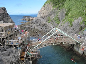
Other islands in Izu Islands
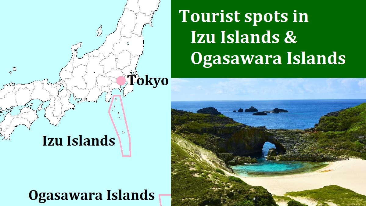
Beach in Niijima
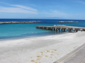
Crater in Aogashima
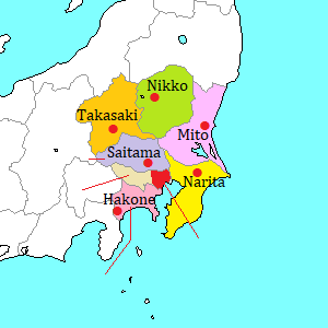
Izu Islands have about 100 islands.
Nine of them are the islands where people are living.
Izu-Ôshima and Hachijojima are the large islands, but the other seven islands are small.
But, each islands has individual characteristics.
You can visit these islands from Tokyo directly.
Between Tokyo (Takeshiba pier near the center of Tokyo) and Izu-Oshima, high-speed ships are operated 3 times a day and a ferry is operated once a day.
And, the ferry puts in at the other six islands in order.
Hachijojima is very far, so another ferry is operated.
To the southernmost Aogashima, the ferry from Hachijojima is operated a few times a week.
But the sailing is sometimes cancelled because of stormy sea.
At that time, you may be stranded for a few days.
A commuter airline operates the flights to some islands.
The airport of departure is Chôfu Airport located about 20 km west of Tokyo. (not Haneda).
And Tokyo Ai-land Shuttle is operated.
It is a flight service by helicopter, and is operated between some islands based in Hachijojima once a day.
(But, only 9 passengers can be on board.)
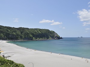
Niijima (新島)
Niijima is located about 40 km south of Izu-Oshima.
It is a slender island about 11 km long from north to south and the width is within 2.5 km.
About 2,700 people live in this island.
There is a high volcano (432 m) in the north part of the island and another volcano is in the south part.
Main village is along the west coast between the volcanoes, and there is a ferry port is also there.
There is an airport at the center of the island.
On the east and west sides of the island, there are some beaches.
They are good for sea bathing and fishing.
Especially, Habushiura Beach (羽伏浦海岸) on the east side is a beautiful beach about 7 km long with white sand.
The beach is a surfing and bodyboarding spot known to the world.
Therefore, waves beating the beach are good for surfers.
The white sand originated in the unique white rocks in the island.
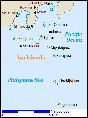
There are many moai statues using the white rock created by various artists in the island.
There are three hot springs in the island.
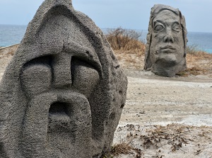
Yunohama Onsen by the west coast is an outdoor bath and the models of ancient Greece are set up.
Moai statues in Niijima
Habushiura Beach in Niijima
Yunohama Onsen
Photo by photolibrary
Observatory in Niijima
Toshima (利島)
Toshima is located about 25 km south of Izu-Oshima.
It is a small round island about 2 to 2.5 km in diameter and there is a volcano (508 m) in the center of the island.
So, there is no beach around the island, and the whole area in the island has steep slopes.
A village with 300 people and a port is at the north coast.
About 200,000 camellia trees are planted.
So about 60% of camellia oil in Japan is produced in this small island.
About 20 dolphins are living around this island.
You can enjoy fishing and scuba diving for the dolphins.
Toshima
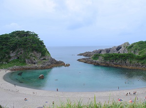
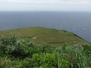
An inlet in Shikinejima
Shikinejima (式根島)
Shikinejima is located about 5 km southwest of Niijima.
It is about 2 km long from north to south and about 3 km from east to west.
About 500 people live in this island.
This island is also a volcanic island, but it is like a 100-meter-high lava plateau.
The coast has many small inlets, so they are popular for sea bathing and camping.
And there are a few hot springs in the south part of the island.
Kôzushima (神津島)
Kozushima is located about 20 km south-southwest of Niijima.
It is about 6 km long from north to south and about 2 to 4 km from east to west.
About 1,800 people live in this island.
This island has two volcanoes.
The northern volcano is Tenjôsan (天上山, 572 m), and it was formed by lava dome after eruption around 840.
The top is relatively flat, and there are some ponds and the observatories.
The village and a port is near the west coast, and an airport is at the south end of the island.
There are some beaches, so you can sea bathing, fishing, diving and camping.
Maehama beach in Kozushima
Photo by Kouzushima Village
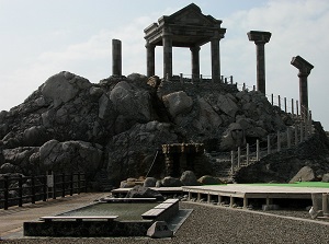
Heart‐shaped pond on the top of Tenjosan
Photo by Kouzushima Village
Akasaki on the north coast in Kozushima
Photo by Kouzushima Village
Coast of Miyakejima
Miyakejima (三宅島)
Miyakejima is located about 70 km south of Izu-Oshima and about 35 km southeast of Kozushima.
It is a round island about 8 km in diameter and there is an active volcano Oyama (775 m) in the center of the island.
About 2,300 people live in this island.
Oyama is very active, and the eruption has often occured.
The great eruption in 2000 was forced to evacuate all people out of the island.
And the evacuation continued for 5 years.
There is a ferry port and an airport on the east coast.
The sea around the island has good fishing grounds, so Miyakejima is popular for fishing visitors.
And various birds live in the island, so it is a good island for birdwatchers.
Mikurajima (御蔵島)
Mikurajima is located about 20 km south of Miyakejima.
It is a round island about 5 km in diameter, and about 300 people live in this island.
There is a volcano (851 m) in the center of the island.
It had become inactive about 5,000 years ago, so the island is surrounded with steep cliffs by seaside erosion.
Deep forest covers the island.
But camping and using bicycle is prohibited and you must walk with the guide when you visit the forest.
And bottlenose dolphins are living around the island, so the diving for the dolphins is popular.
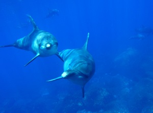
Dolphins around Mikurajima
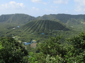
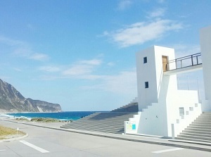
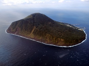
Caldera of Aogashima
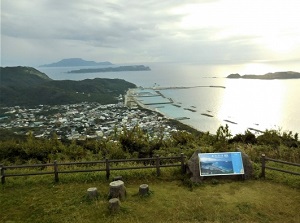
Aogashima (青ヶ島)
Aogashima is located about 70 km south of Hachijojima.
And it is the southernmost island of Izu Islands, and is located about 350 km from Tokyo.
It is about 3.5 km long from north to south and about 2.5 km from east to west.
About 160 people live in this island.
This island is the top part of a submarine volcano.
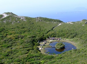
It is a caldera volcano, so the central crater is at a little south from the center of the island and the wall of mountains surrounds the caldera.
The highest point is 423 meters at the sea level.
Steep cliffs about 50 to 200 meters high surround the island.
The village is at the north side of the caldera.
The main tourist attraction is the unique nature.
There are some fumaroles of steam in the island. They are called Hingya.
At the northern tip of the island, we can look at fantastic starry sky.
Some say that is "Colosseum of Starry sky".
In addition, "Aochu" is a clear liquor distilled from sweet potatoes produced in only Aogashima.
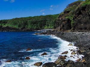
Sea of Aogashima
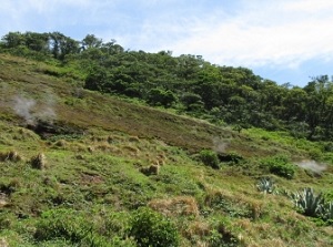
Hingya in Aogashima